Cleaning the Initial Data in ArcGIS
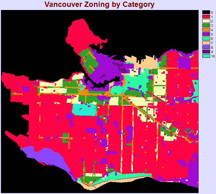
The majority of the City of Vancouver Open Dataset contains mostly vector files in the form of shapefiles which are not interoperable with Terrset without conversion. The initial zoning file available from the City contained several spatial inaccuracies due to poor digitization. For zones along the coastline, the boundaries extend into the water. Since this file will be used to classify land use and identify areas impacted by sea level rise, boundaries extending into the water will alter the analysis. This needs to be corrected.
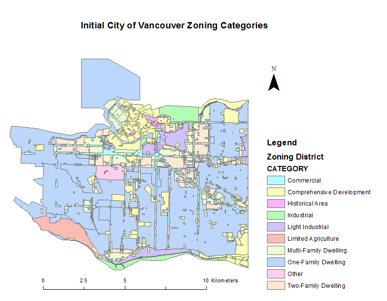
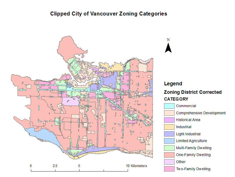
In order to fix the zoning files from the City to conform with land boundaries, I overlayed the City’s 1 metre contour line file with the dataset and used a database query to only show contour lines at 0 metres. By exporting the 0 metre contour line to an individual shapefile, I closed the polyline to create a polygon and used the “Feature to Polygon” tool to create a polygon shapefile from the polyline. Using the polygon file, I clipped the zoning file to accurately show the coastline. The result is below.
Projecting the Digital Elevation Model (DEM)
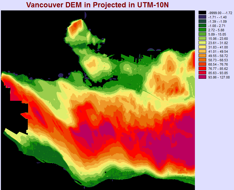
Terrset has a limitation when importing DEM files using the GEOTIFF/TIFF tool. It does not accept BigTIF files and therefore requires the GDAL Raster Conversion Utility. Using this tool, I converted my TIF file into a Raster file. Unfortunately, the original file did not have a projection assigned to it even though it was created in UTM-10N. In order to ensure the file conforms with all of the other rasters, I re-projected it in UTM-10N using the PROJECT module. Then, the output was the output classified into 16 classes using quantiles.
Converting from Vector to Raster
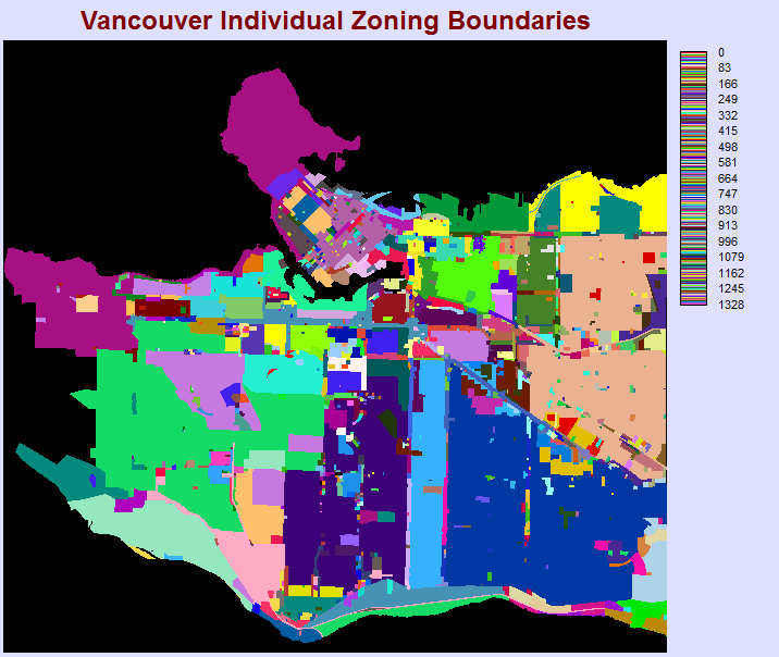
Using this corrected file, I imported this shapefile into Terrset using the “ShapeIDR” module. This gave me a vector file to use in Terrset. I used the “Initial” module to create a raster file using the spatial parameters in the DEM file. I then used the RASTERVECTOR module to convert the vector file into raster with the operation type set to “Change cells to record the identifiers of polygons”. This gave me the following output.
Reclassifying Zoning Cells
Each cell has been assigned a value from 0 to 1328 based on the discrete zoning areas digitized by the City of Vancouver. There were 1328 individual polygons for each zoned area. In this initial raster, each cell has not been assigned a zoning category (e.g. single-family residential, commercial, industrial, comprehensive development). To reclass the data, I exported the original shapefile attribute table which had each polygon categorized from ArcGIS into a CSV. Using the CSV, I cleaned up the data and assigned values for categories from 1-10 based on the category. The values were assigned as follows:
1 = One-Family Dwelling
2= Two-Family Dwelling
3= Multi-Family Dwelling
4= Commercial
5= Comprehensive Development
6= Light Industrial
7= Industrial
8= Limited Agriculture
9= Historical Area
10= Other
Using the following Excel Formula, I classified each polygon identifier:
IFS(C1=”One-Family Dwelling”,1,C1=”Two-Family Dwelling”,2,C1=”Multi-Family Dwelling”,3,C1=”Commercial”,4,C1=”Comprehensive Development”,5,C1=”Light Industrial”,6,C1=”Industrial”,7,C1=”Limited Agriculture”,8,C1=”Historical Area”,9,C1=”Other”,10)
I exported a CSV with two columns, one for the Polygon Identifier and one for the Land Use Value. Within Notepad, I removed the commas in the CSV and replaced them with a space. Copying that data into Terrset, I created an Attribute Value File (.AVL) to use in the “ASSIGN” module to reclass each cell into its proper land use category. This was the output.
