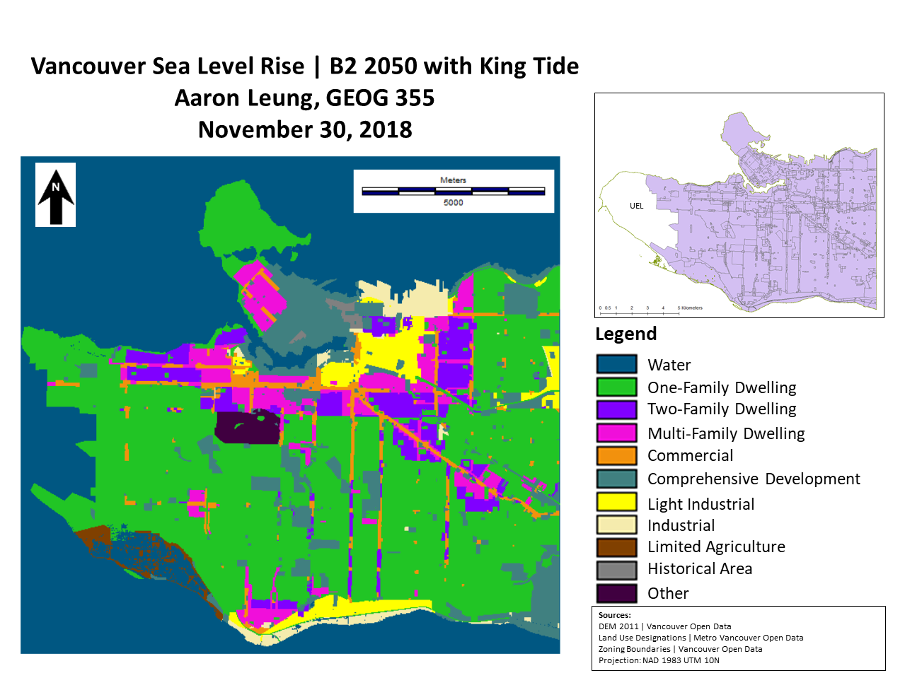
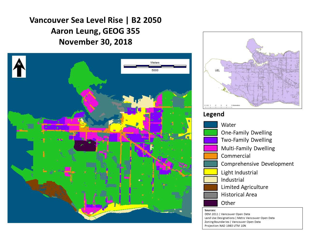
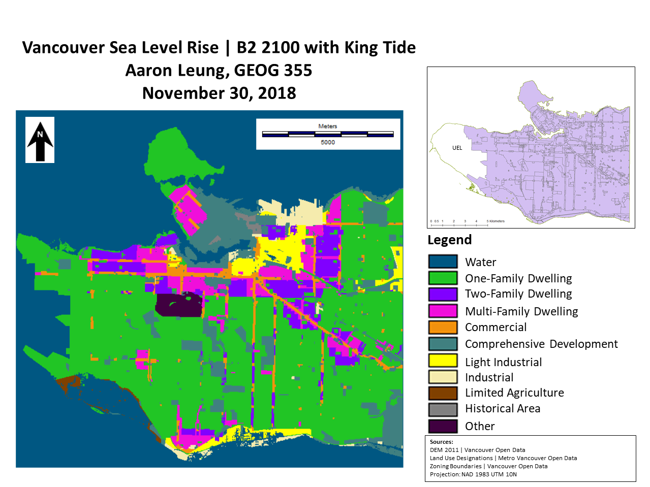
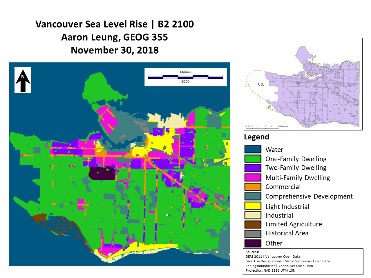
The B2 (Local and Regional Sustainability Pathway) leads to the second highest level of sea level rise and temperature change across the three scenarios. However, it should be noted that this is only a modest half squared kilometre impact increase from the A1T scenario. This pathway assumes that humans reduce their dependency on fossil fuels but instead of a global strategy and policy direction, local areas and regions take on the initiative of building more sustainable communities. B2 focuses on the impacts of local and regional action By 2100, Earth’s average temperature will increase by just over 3.5 degrees Celsius which is just over double the limit of the Paris Agreement, but much better than six degrees under the fossil fuel intensive scenario (UNCC, 2018).
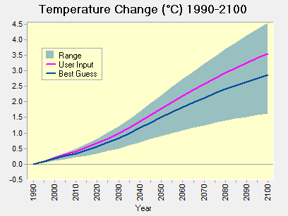
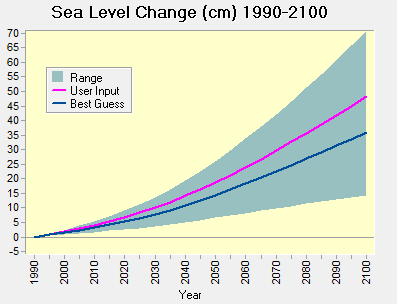
The result is an average sea level increase of just over 45cm by 2100 and as high as 70cm. The resulting impact floods most of Vancouver’s limited agriculture area as well as light industrial lands on the Fraser. Stanley Park is also heavily impacted. Under 2050 sea level rise conditions and above, all of Vancouver’s zoning areas with the exception of “Other” will see some land lost due to sea level rise with impacts increasing into the future and through King Tide events which add up to an extra one metre of sea level rise. Single Family areas and Comprehensive Development zones are the most impacted.
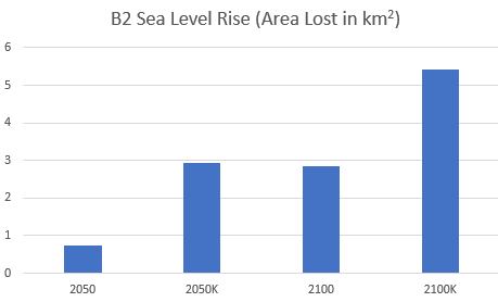
Vancouver will lose up to 5.5 square kilometres in a king tide event in 2100 with just under three square kilometres being submerged under average sea level rise by 2100. Businesses and residents in the impacted area will need additional flood mitigation measures or be relocated entirely.
References
UNCC. (2018). The Paris Agreement. Retrieved from https://unfccc.int/process-and-meetings/the-paris-agreement/the-paris-agreement
